Lower North - Geology, geography and a short-ish history
Peter Berg and Peter Riley, New Zealand Tree Grower May 2012.
The Lower North branch of the NZFFA extends over a distance of approximately 100 km. It is generally considered to stretch from the centre of Auckland city, the Manukau Harbour and Waitakere Ranges in the south west and the Waitemata Harbour in the south east, to Mangawhai and the Brynderwyn Hills in the north. Over most of this distance the land seldom exceeds a width of 40 km, stretching from the often quite boisterous Tasman Sea in the west and the much more benign Hauraki Gulf in the east.
The Kaipara harbour creates a huge indentation on the west coast while in the east the Hauraki Gulf is notable for a scatter of islands, mostly of volcanic origin. The landscape is mainly hilly, with areas of rolling country and less extensive alluvial plains where the geological process has been kinder.
Some geology background
The geological history of this area has been dramatic, with land and sea subsiding and then rising over the last 100,000 years and tectonic forces buckling the landscape into ridges and valleys. The Brynderwyn to Bream Tail ridge at Mangawhai, and the Cape Rodney, Dome Valley to Mount Auckland ridge, near Warkworth are examples of this. These ridges rise to 300 metres in height across the isthmus. At depth, the bedrock is a fine-grained greywacke, or argillite, a hard rock quarried for aggregate although exposed rock is generally only found in deeper stream gorges.
Overlying this is the Waitemata sandstone, generally horizontally bedded in thick layers up to two metres deep, and often inter-bedded with thin, more shaly material. This is a weaker rock, not suitable as aggregate, but hard enough to stand up in cuttings. These softer sandstones weather down into yellow clay. Layering and weathering of this material, when combined with deforestation and heavy rain, can lead to significant landslides in hill country and particular care is need in these areas.
Coastal processes have also been extreme, with sea levels falling in the last Ice Age 20, 000 years ago, to 40 metres below where they are now. Wide coastal plains formed, with river mouths in the Hauraki Gulf between Cape Colville and Great Barrier Island, and Great Barrier and Whangarei Heads.
Major volcanic eruptions from Taupo filled rivers with sand. The Waikato River diverted to flow down the Hauraki Graben past Thames carrying vast volumes of sand and forming plains out to Great Barrier Island at 40 metres below the present sea level. There was a useful consequence. When sea levels rose over the following 10,000 years, wave action pushed the deposited sand towards the shore. Sand filled embayments and extensive sandy plains were created, accumulated silt from the surrounding hills, and formed swamps and occasional fertile plains for settlement. Coastal dunes formed on both coasts and are now subdivisions represented by settlements such as Mangawhai and Omaha.
Minor volcanic activity occurred in places, leaving behind plugs of volcanic rock such as the Sugarloaf at Matakana, and the Ti Point headland. The hot springs at Waiwera and Parakai confirm our connection to Mother Earth.
Settlement and development
Tall kauri forest grew on much of the landscape, providing a resource for Maori who first settled here about 800 years ago. Rich basaltic volcanic soils were ideal for gardening and suitable land also accessible to the sea was soon cleared and developed. Through most of the period of Maori settlement the isthmus was an important route for travellers.
With the arrival of white settlers the value of the forest resource was recognised and through the later part of the 1800s was the basis for a major export trade. Kauri trees were felled and floated down rivers, and either milled or exported as logs. Trading scows were often built from the kauri for this purpose. Kauri was exported to Australia and the United States. For a period of time forest products were New Zealand’s largest export item but by the early 1900s supply was seriously depleted.
Kauri to farming
Part of the impetus for clearing the forest was the desire of new settlers to establish farms on their own block of land, and of course the belief that the forest resource was inexhaustible. A H Reed in his book The Story of the Kauri not only records the vigour with which the kauri harvest was pursued but also tells of other, probably much more extensive losses due to careless use of fire. In 1896 Archdeacon Philip Walsh reported − ‘No description, however verbally accurate, will convey an idea of the scene of desolation presented by the kauri bush after a fire has gone through it.....the slightest scorching about the root is sufficient to kill a kauri tree....A roaring torrent sweeps through the bush; every tree becomes a blazing torch; in an incredibly short time all that are left are a few smoking trunks and fallen logs. Before many years are past scarcely a charred stump remains to mark the site of one of the grandest triumphs of nature...’
This trade and associated land clearance has been the subject of many books. It left behind many empty valley most of which are now homes to farms and pine forests.
Kauri gum prices increased in 1880 and 1890s, creating a new and valuable trade, particularly in the Kaipara catchment. Flat swampy areas were probed with spears to find fossilised kauri gum. This had high value for top quality varnish manufacture and was also a major export item. Beautiful examples of kauri gum can be found in local museums at Matakohe and Warkworth.
Farming and horticulture
Present day land use includes market gardening on fertile alluvial flats, with sheep and beef farming on the hill country. Early trials showed potential for wine grapes on land near Henderson and Kumeu, in Auckland's western suburbs, with vineyards producing good quality wines. More recently Matakana soils have also responded well to viticulture with a wine industry established there.
Sheep and beef farming is also a major land use with well established sale yards at Wellsford. Fertiliser input is vital as local clays are generally considered phosphorus impoverished.
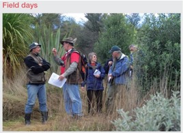
Forestry is a dominant land use component on steeper hill country. Radiata pine, eucalypts, blackwoods, other special purpose timbers and a renewed interest in growing native species are attracting owners to field days in the area.
Landslides in heavy rainfall are problematic in steeper hill country, and tree plantations can help with land stabilisation and flood mitigation downstream. Tropical storms from the north can bring extreme rain. Our branch chairman, Peter Riley, recorded 270 mm of rain overnight during Cyclone Wilma on 29 January 2011. Many of the resulting slips have taken months to clean up but his pine plantation, which was planted on suspect ground, successfully weathered the storm.
Forestry development
There were many consequences of the earlier period of extensive land clearing and development. Land which had been worked over for kauri gum was often difficult to work, weedy and very infertile. Along the coastlines large sand dunes were set free and quickly began to overtake important road and rail corridors. Once the kauri supply dried up demand for timber for construction resulted in increasing supplies being imported.
The newly established Forest Service confirmed that without careful husbanding of remaining native forests and hasty implementation of a replanting programme with fast growing exotic tree species New Zealand could well run out of wood supplies. The lower north featured in this with the extensive sand dunes of the Muriwai and later Mangawhai coasts being included in very early planting trials. They were subsequently planted over the next couple of decades. At Riverhead, heavy waikare clay turned over by a generation of gum diggers was also converted to forestry.
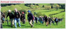
The forests pioneered other aspects of forest management which became standard practice throughout New Zealand, including the use of fertilisers and weedicides. A number of landowners picked up on aspects of this practice, modifying things to suit the scale of their activity and experimenting with a range of other promising species. Prominent among these was Neil Barr who went on to found the NZ Farm Forestry Association and push the cause for a number of other species but particularly the eucalypts. Some of these matters are illustrated in the articles which follow, and will be on show at the 2013 conference.