
This is free.
Eyes in the Sky
Michelle Harnett and Jonathan Dash, New Zealand Tree Grower May 2017.
Lit up like a Christmas tree is a good description of a laser-generated image of a forest. Stunning images aside, research in New Zealand and overseas is showing that the hype around laser light detection and ranging, known as LiDAR, is justified. Information obtained from laser scanning forests is increasingly being used in managing large forests. But what can the technology offer owners of small to medium forests? Answering this question is the job of a team of scientists at Scion.
The Forestry Industry Informatics group in Scion deals with geomatics – the collection, analysis and interpretation of data relating to the earth’s surface.They are exploring ways to gather data using remote sensing technology, techniques for extracting information from the data, and practical uses for the information.This can be mapping and surveying forests, monitoring forest health, assessing the volume and value of standing trees, as well as planning and carrying out site-specific forest management activities.
How LiDAR works
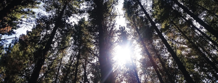
If sunlight can penetrate a forest canopy, so can the near infrared laser pulses emitted by airborne laser scanners. The lasers pulses are reflected as they make contact with branches, foliage and finally the forest floor.These returns from the pulses are detected by the sensors of the airborne laser scanners system.
An accurate measurement of the time taken from a pulse being emitted and returned allows the distance of an object from the sensor to be calculated. Combined with data from GPS receivers to track altitude and location, and an inertial measurement unit which tracks the tilt of the aircraft, each return from the pulse can be converted into a three-dimensional coordinate.
Making sense of the data
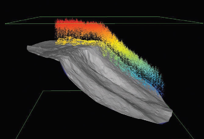
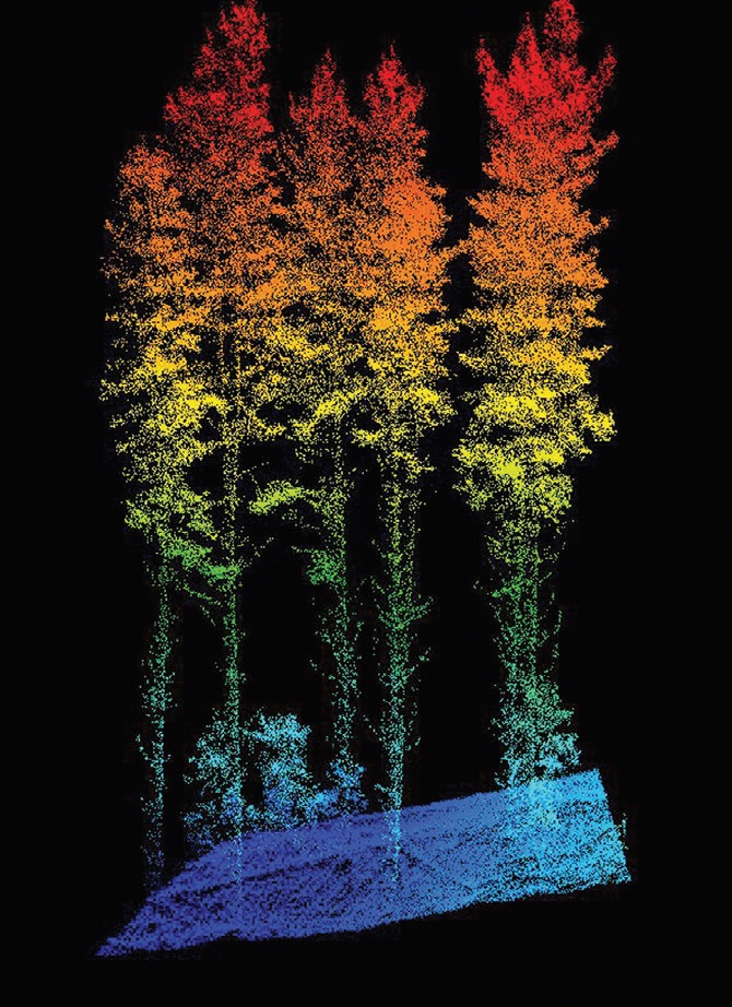
An enormous amount of data is generated during a LiDAR flight. Some scanners send out up to 200,000 pulses a second and up to seven returns can be recorded from each pulse. Advances in computing power are making managing the number of data points easier and cheaper. Collectively, the data points, each defined with its unique coordinates in three dimensions, create a point cloud which represents the surface of the landscape or object scanned.
The last return of the laser pulse, the hit reflected from the forest floor, can be identified and classified using special calculations. Once these pulses are identified, they can be triangulated to generate a digital terrain model.These surfaces are the most detailed description of the forest floor. Further data processing can be used to extract information on the conditions the trees are growing in, including slope, aspect and the presence of streams and other objects. Information from the digital terrain model is also valuable when it comes to siting and engineering access roads, skid sites and planning harvesting operations.
The digital terrain model can also be used to convert the height coordinates in the remaining vegetation point cloud into local heights, and a canopy height model can be determined from this information. Statistical modelling can then be used to extract information about forest and tree structure, and to align the LiDAR data with measurements recorded in ground plots.
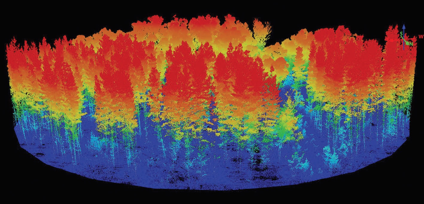
Forest patch level analysis can be used to estimate a stand’s volume, the mean top height, or the amount of biomass or carbon it contains. Using data analysis techniques, LiDAR data can be used to predict log volumes and yields for any stand, with fewer field plots needed than using a conventional inventory method.
At the individual tree level, research is focussing on identifying and identifying tree crowns in the point clouds and detailing a tree’s form and dimensions to measure tree traits. Characterising the growth and performance of every tree in a forest could lead to an improved understanding of the factors which influence tree growth and wood quality.
Similar laser scanning can also be carried out from the ground.Terrestrial systems can be stationary or mobile and are useful at tree or plot level, or when very detailed measurements are needed. Mobile units can cover larger areas quickly, view objects from all sides and be used in rougher terrain. Scion has tested a hand-held unit to locate and measure the lower stems of individual trees in detail. For example, pruned height, stem straightness, taper and lean of pruned trees can be measured. Combining terrestrial data with an aerial LiDAR assessment of the canopy offers the possibility of scanning and characterising inventory plots very accurately.
Other remote sensing options
Airborne laser scanning is an active remote sensing technology which uses energy with a wavelength which is in the near infrared portion of the spectrum.The absorption and reflection of energy from other parts of the spectrum also provide valuable information.The red, green and blue portion of visible light can be useful for mapping and monitoring forests and can also be obtained using relatively low-cost and simple cameras.A much broader range of spectra can be obtained by multi and hyper-spectral sensors.These can be used to reveal traits related to tree physiology, for monitoring disease outbreaks and for distinguishing between different tree species in mixed forests.
Satellites orbiting the Earth are alternative sources of information.The number of satellites has increased significantly since the 1970s. Satellite sensors are provided by organisations such as NASA and the European Space Agency and more recently by a host of commercial providers.The data is becoming increasingly available and is cheap or even free.The major advantages of satellite imagery include the frequency of data collection and the possibility to acquire regional or global perspectives on land-use patterns. Updated data can be obtained up to twice weekly in some cases and short term changes, such as areas of poor growth or changes in foliage colour due to disease outbreak, can be picked up. Satellite data can be combined with LiDAR data to tease out more, and different information.
Practical LiDAR applications
Forest researchers, owners and managers have been very enthusiastic about the potential of LiDAR and other remote sensing possibilities. Scion scientists have been very active developing and adapting the technology and modelling techniques for local conditions that are now being used in forests.
Predicting site productivity and forest yield
Forestry scientists Michael Watt, Jonathan Dash and others have investigated the potential of using LiDAR data and satellite data to predict forest productivity, forest structure and forest yields usually acquired from carrying out forest inventories.The researchers found that their models precisely predicted the forest productivity indicators known as Site Index and 300 Index. This meant that for the first time the productivity within a stand could be mapped.Where LiDAR data was unavailable, or too expensive to acquire, a combination of satellite imagery and environmental information could be used without losing too much precision.
Pin-pointing wilding pines
A combination of LiDAR and multi-spectral aerial imagery has also been used to detect wilding pines in a tussock land and scrubby landscapes. One of the most effective and cost-efficient ways to control wildings and their ecological and economic effect is to detect and eradicate them before they start to produce cones. However, identifying juvenile and scattered trees currently relies on helicopter and ground-based surveys which are expensive and depend on the abilities of the observers.
Jonathan and his colleagues have recently investigated the potential of using remote sensing to detect small and individual trees.They found that data from laser scanning is useful for finding taller, isolated trees in short vegetation but is not as effective when tall tussocks, shrubs and other trees are present. However, when LiDAR data was combined with multi-spectral data obtained by aerial photography, they were able to develop a method to detect wildings and differentiate them from other tree species in the landscape.
Identifying individual trees
LiDAR methods have also been developed to identify and characterise individual trees. Information about a tree’s appearance, or phenotype, which is the result of a combination of the tree’s environment and genetics, can be used to identify trees with desirable genetic traits.
Work carried out by Dave Pont, who specialised in tree crown architecture, compared measurements derived from the LiDAR data for 36 individual tree crowns with those taken from the ground. He discovered that the data for the crown, tree height, diameter at breast height and volume was the same. But for tree form and wood quality, LiDAR and ground based measurements differed.This showed the potential for using airborne laser scanners to identify well performing trees which could be used in a genetic improvement programme.
Using unmanned aerial vehicles
Marie Heaphy is a licensed unmanned aerial vehicle or UAV pilot and responsible for developing Scion’s UAV capabilities. She is looking forward to drone flights replacing manual surveying and putting behind her the joys of pushing through head high blackberry while avoiding breaking an ankle.
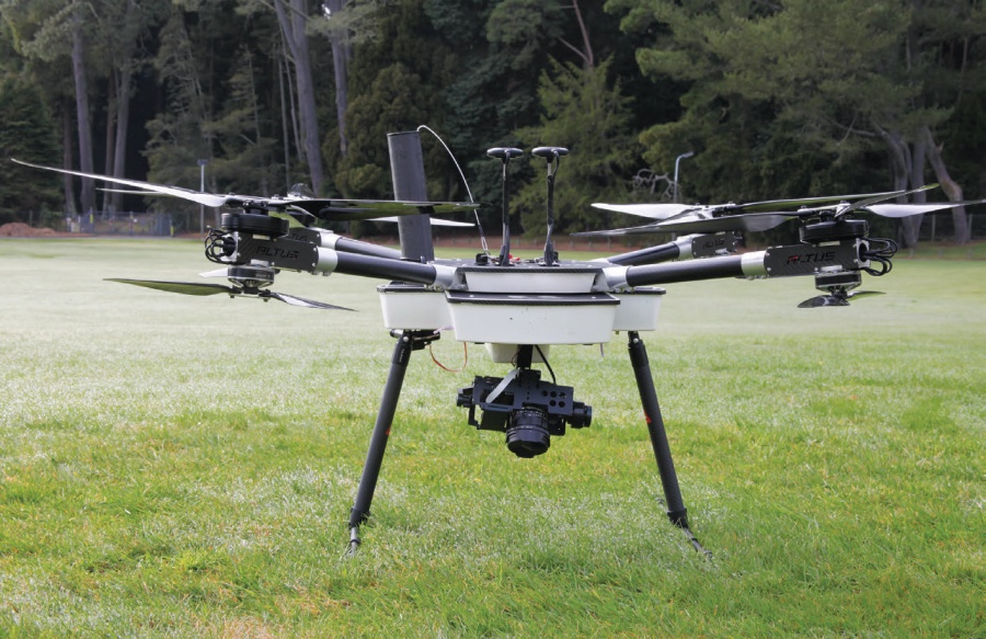
Scion lease their current craft because this mitigates the risk of losses due to equipment failure in flight, and allows more frequent updating to keep up with rapidly changing technology.The sensors available for use include laser scanners, conventional cameras, multi- spectral and thermal sensors.
The research focusses on developing and transferring UAV applications to forestry and other primary industries. For example, just as the volume of a forest stand can be estimated, harvest volumes of fruit, vegetables and grain crops can also be estimated and used to optimise harvesting.Another area of interest is using thermal imagery to detect animals and use variations in body temperature as an indication of infections such as foot-and-mouth disease.Thermal imagery can also be used to detect and pinpoint hotspots after wildfires. Marie anticipates longer range flying in the future, and the cost of flying larger areas decreasing, which will make regular data updates more feasible.
Flying over small and medium forests
A quick Google search shows there are a number of commercial operators offering LiDAR and aerial remote sensing services using conventional aircraft and UAVs. Surveying and scientific data collected and interpreted professionally can provide useful results at a scale suitable for farm foresters. However, flying over a small or medium size forest can be expensive on a per hectare basis. Working cooperatively with a neighbour or a group of other forest owners could be a more cost-effective option.
After data is collected, it still needs to be interpreted, which at the moment is a job for specialists. But the costs of data collection and interpretation are falling and, as LiDAR information becomes more affordable, it will be used more frequently.
A very simple and affordable option for forest inspections could be to send a small drone with video capacity over a forest block.While it is not usually possible to obtain measurements from the video, if carried out regularly, drone flights could be used to monitor changes in forest health, notice areas of slow growth or check on storm damage.
The curious forest owner wondering what remote sensing has to offer them could take part in a new research programme which aims to develop methods for estimating the value and volume of small to medium forests that is being run by Jonathan Dash and MichaelWatt.This is presented in the article on the following pages.
Funding
Much of Scion’s remote sensing research is supported by the Growing Confidence in Forestry’s Future programme which is jointly funded by the MBIE and the Forest Growers’ Levy Trust. Scion are also investing heavily in this area using internal funding.