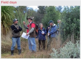
An introduction to the Southland region
Gary Morgan, New Zealand Tree Grower February 2009.


The Southland Region covers an area of approximately 2.3 million hectares. Southland’s coastline is 3,400 km long and stretches from Brothers Point in the Chaslands on the east coast to Awarua Point near Martins Bay on the west coast. The Southland District also includes Stewart Island, the Solander Islands and Ruapuke Island. In the north Southland is bounded by various mountain ranges including the Eyre and the Garvie Mountains which generally separate it from the remainder of the South Island.
The main urban settlements are Invercargill, Bluff and Gore, Lumsden, Mataura, Oban on Stewart Island, Otautau, Riverton, Tuatapere and Winton.
Southland – The end of the tail
To Maori, Southland is known as Muruhiku, which means the end of the tail. Maori folklore mentions two Polynesian explorers, Toi and Kupe, who are said to have ventured into the southern regions of New Zealand in ancient times. There are also several migration canoes mentioned in Maori tradition, from which various tribes trace their ancestry. Two of the important southern ones were the Takitimu and Araiteuru canoes. These southern regions of Aotearoa were explored around 800 years ago by many canoe journeys along the rugged southern coast and on foot along wild river valleys and over hazardous mountain passes.
The early southern Maori were hunter-gatherers and did not practise agriculture. Their culture lacked metals and they were dependant on stone, bone, shells, flax and wood for their tools.
They were few in number and moved with the seasons around the various food resources of the region. One of the most important of these were the muttonbirds of Foveaux Strait, still harvested under customary rights.
The early people lived hardy and vigorous lives, with an average lifespan of only 25 to 30 years. Te Rapuwai and Waitaha were early names for these original southern colonists. Later arrivals from northern New Zealand in the 1500s were the Ngati Mamoe, and then in the 1600s the Ngai Tahu.
Mostly forest
Before Maori arrival most of lowland Southland was forested. The only major exceptions were the bogs and wetlands in the main river valleys along with the frost flats and cold hollows along the floors of inland valleys, such as the Eglington and the Upper Oreti, where red tussock would have grown.
In the west in Fiordland and on the Takitimu Mountains, and in an arc across the hills of northern Southland, beech forest prevailed. Towards the east there were increasing areas of tussock and the forest was more and more confined to valleys.
The lowland forest, now much reduced in area, was a mix of podocarps and hardwoods. On the plains and on the more fertile hill soils there was matai and kahikatea as well as rimu in the kamahi and rata matrix. The largest remaining area of this forest is on the Hokonui Hills, although there are many remnants elsewhere, both on the hills and plains. On less fertile soils and in wetter climates rimu was the dominant podocarp and this forest type is found along the Western Southland coast, on Stewart Island and on the Eastern Southland hill country.
From 1840 to 1850 the first European farmers settled around Invercargill and the first wool was shipped from there in 1857. By 1860 settlement had spread into most of the suitable farming country, with development concentrated along the major rivers.Wool and timber were the main sources of income until refrigeration, and sawmilling was encouraged by the Otago goldrush and the growth of Invercargill and Dunedin.
Landscape provides character
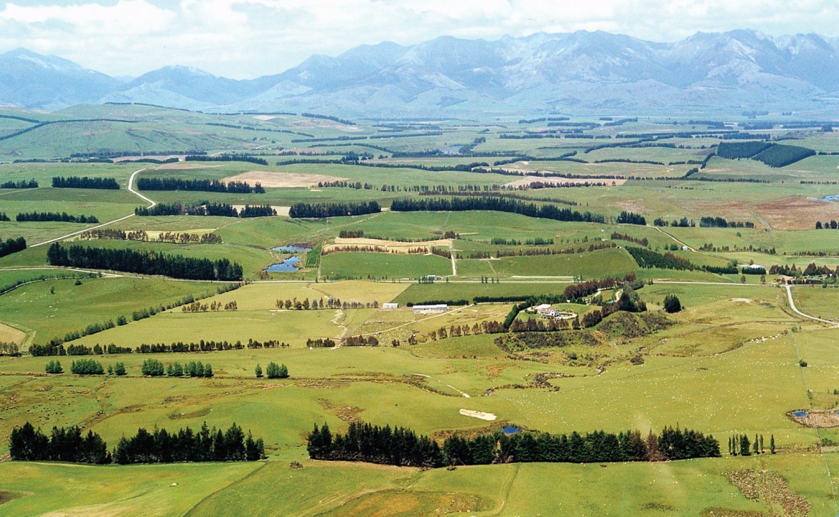
Within Southland there is a range of landscape forms, including plains, rolling hills in bush and pasture, vegetated, barren or snow covered mountains, harbours, rocky bluffs and sandy beaches. These landscapes provide the character of the region, which is highly regarded nationally and internationally.
The lowlands of Southland form the second largest of the peripheral plains of New Zealand and can be divided into five separate areas −
- Central Southland plains
- Waimea plains
- Upper Mataura valley
- Lower Waiau valley
- Te Anau / Manapouri basin.
Separating these lowlands are the Takitimu mountains, and the Longwood Range in the west, and the North Range and Hokonui Hills mirroring the north-west to south-east alignment of the Waimea plains and the central Southland plains.
Climate – cooler and frosty
Southland is cooler, has less sunshine and more frosts than the rest of New Zealand. The prevailing winds are south westerly, often strong around the coast and lighter inland apart from occasional gales. The inland wind of concern to foresters is from the north west − dry, gusty and sometimes violent.
The westerly winds bring a plentiful supply of moisture so that most of Southland is usually green. The western ranges of Fiordland are as wet as anywhere in the world – Milford Sound averages nearly 6,500 mm. Rainfall in the east is less extreme though generally well distributed throughout the year, with Gore averaging 840 mm and Invercargill 1,040 mm. Seasonal dry spells can pose problems for farmers in northern Southland.
Climate zones
The climatic zones of Southland are often more important than the soil type in limiting the choice of tree species. There are three distinct zones.
Coastal This zone is subjected to fairly constant cold salt-laden winds from the south and west.This restricts the range of species that can be used for primary shelter although a wide range can be grown in the lee of salt tolerant species. Because of the land contour, severe coastal conditions are restricted to a narrow zone of two to three kilometres in western Southland,but on the plains around Invercargill and to the east this zone extends up to 35 km inland.
Intermediate This zone runs across central Southland and has a generally temperate climate with few severe frosts. It is subject to both south-west and north-west winds. Rainfall is generally adequate. A large number of tree species can be grown successfully.
Inland The zone lies in the northern region of Southland.Species in this area need to be able to cope with out of season frosts and dry, hot north westerly winds. Frosts are severe in winter and snow can also be troublesome, especially in hilly areas on south easterly aspects.
Geology
Fiordland and Stewart Island are underlain by hard,coarsely crystalline rocks such as granite, gabbro, schist and gneiss of Mesozoic age. The Takitimu and Longwood ranges are formed from volcanic lava flows and volcanic sandstones of Paleozoic to Mesozoic age. Intrusive rocks form the hills at Riverton, Bluff and Greenhills.
One of the best known geological structures in Southland is the Muruhiku escarpment or Southland syncline. This is a feature of regional extent that can be traced from the Catlins coast to the main divide near Key Summit. It is formed of bedded Mesozoic volcanic sandstones, which were steeply folded into the characteristic razor-back ridges of the Kaihiku, Hokonui,Taringatura and North Ranges.
The northern Southland ranges, including the Livingstone, Eyre and Garvie mountains, are formed of greywacke and schist.
After the older basement rocks had been formed, folded and faulted, Southland underwent a long period of erosion until near the end of the Cretaceous period. The next youngest rocks, Cretaceous to Tertiary, are widespread in Southland, and are generally much softer than the basement rocks and have not been as intensely folded. These include coal bearing strata at Ohai and beneath the Waiau Valley. Overlying strata include limestone, extensive mudstone in the Waiau Valley, sandstone in the Te Anau Basin and lignite deposits, inter-layered with sand and mud in the Mataura Valley.
Regular land movement
Major faulting, folding and uplift has affected the Southland region in the last 15 millon years or so. This activity continues to the present day, and has been responsible for uplifting the mountains of Southland, and of the South Island in general. These movements give rise to the frequent earthquakes centred beneath Fiordland.
The younger sediments were once more extensive across the Southland region but have been eroded from the rising land in many places. Erosion of the ranges was particularly rapid in Fiordland, where several episodes of glaciation over the last two million years have produced a spectacular landscape. Glaciers deposited large moraines and rivers transported the gravels that infill the valleys and lowlands of Southland.
Mineral resources include limestone and aggregate. Metallic minerals occur in the basement rocks of Fiordland, Stewart Island and the Longwoods. Hydrocarbons and coal are found in Cretaceous and Tertiary sediments. Southland has the most extensive coal resource in New Zealand. Offshore hydrocarbon potential is currently of interest in the Great South Basin.
Soils
The soils of the Te Anau Basin and the plains and uplands north of the Southland syncline are mainly brown earths or related stony soils. The Te Anau soils have developed on stony glacial moraines derived from granite and greywacke eroded off the surrounding mountains, and these glacial deposits have also been the source of the wind blown loess soils of the downlands and plains to the east.
The lands south of the syncline are split by the main Southland rivers − the Waiau, the Aparima, the Oreti and the Mataura. There is a narrow fringe of recent alluvial soil and stony terrace soils along the floodplain of each river, then loess covered downlands and rolling terraces where the loess accumulated.
These downlands form the Southland plains, one of the most productive agricultural areas in New Zealand. The annual rainfall of 1,000 mm to 1,200 mm is well distributed throughout he year, and it is this available soil moisture during the summer and early autumn growing season which gives the soils of the plains such an advantage in pasture production. Because of their high moisture status these loess based soils have weathered into lowland yellow-brown earths, with occasional pockets of peat where drainage is blocked.
The soils of the hilly lands of the Southland syncline are typical yellow-brown earths with a variable and shallow loess cover. They are suitable for plantation forestry with minor limitations due to shallowness and altitude.
Economic activity
There are around 5,300 farms in Southland covering an area of 1,250,000 hectares. Sheep and beef cattle are still dominant, although over the last 15 years there has been a huge increase in dairying in the province. In 1993 there were 71,000 dairy cows in Southland.
In 2007 this had increased to 345,000. The number of dairy farms now totals close to 700 with projected conversions of 100 farms a year for the next three years. Deer farming is strong in Southland with 22 per cent of New Zealand’s deer herd.
Fifteen percent of the electricity generated in New Zealand comes from the Manapouri power station. The Tiwai aluminium smelter produces around 270,000 tonnes of aluminium a year from imported ore. There is a vigorous fishing industry based on dredge oysters, rock lobsters, paua, blue cod, freshwater eels and farmed salmon.
The area of planted production forest totals around 60,000 hectares. Of this about 25 per cent is in holdings of less than 100 hectares. Other points of interest to foresters are −
- Significant Douglas fir plantings in recent years on tussock country in northern Southland
- Thriving eucalyptus chipwood export industry
- New Zealand’s largest sustainable indigenous harvesting programme based on silver beech is in western Southland.